Highway 224 & the Upper Clackamas River - Part 2
- Tina McLain
- Jul 28, 2025
- 7 min read

A break down of all viewpoints, river access points, seasonal waterfalls, and hikes along the Clackamas River from the National Forest Boundary to the Historic Memaloose Weigh Station.

Part 2 explores seven waterfalls, two pull-offs, and one view. This section is mainly within national forest, but a few small sections are BLM land.
For more information on activity ideas, resources, safety, and a list of each place by category check out my Highway 224 & Upper Clackamas River - Overview post.
Recreating in Burned Areas
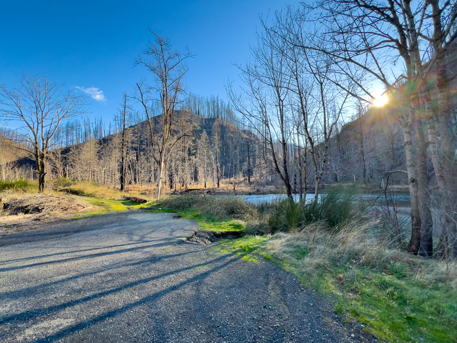
The majority of the Upper Clackamas River was affected by the 2020 fires. Large amounts of the area have reopened as of 2025. There are still a few areas/roads that are closed to public access.
As I’ve noted above, the majority of the Upper Clackamas River was affected by the 2020 fires. Large amounts of the area have reopened as of 2025. There are still a few areas/roads that are closed to public access.
As with any aspect of recreating outdoors, it’s important to make sure what you’re doing is legally open to the public. For up-to-date information on what is open, check out the Mount Hood National Forest website.
Another important aspect to consider when recreating in burned areas is the additional hazards and risks, such as unstable slopes/ground, flash floods, potential for falling trees/limbs, etc.
I really encourage everyone to check out the forest service page, “Safety in Burned Areas,” which discusses how to stay safe in burned areas.
Seasonal Waterfalls Disclaimer
I designate “waterfall” as any amount of water that flows or drops a vertical (or mostly vertical) rock surface. I use the word waterfall rather loosely, and I don’t use any official parameters for what is designated a “waterfall.” Basically if it appears to be falling water, I label it as a “waterfall” for ease of use.
There are a plethora of seasonal waterfalls along the upper Clackamas River. There's no way I could note all of them. So, I'm going to focus on marking those that are 1) most visible from along Highway 224, and 2) the most noticeable/my favorite ones. There are still plenty that I haven’t noted in this post. There are two that I know of that I didn’t add due to it not really being possible to photograph them. So, keep your eyes peeled for waterfalls along the way.
Some are best seen driving a particular direction (east vs. west), so I'll make sure to note which direction has the best visibility when discussing the waterfalls.
Winter/spring is usually the best time to see the waterfalls, particularly after some consistent/heavy rain. There is no guarantee the waterfalls listed will be present at different days/times of year. For the most luck in seeing waterfalls, it’s best to go after there’s been some heavy/prolonged rain along with snow melt.
All seasonal waterfalls are approximate coordinates, it gives the idea of where the waterfall is, but there is room for error on my part.
Pull-offs Disclaimer
I note a majority of the pull-offs along Highway 224, but there are some I’m sure I didn’t cover. It’s as close to being comprehensive as I could get. There is some subjectivity involved as to what constitutes a “pull-off.” So there are some areas others might consider pull-offs that I didn’t note.
There are some pull-offs that have boot paths leading to the river or river views, which I do my best to mention. Most of the photos I took are of the pull-off’s themselves since it is easier to eye that if you go driving yourself. Some places I included pictures of the river, but not in all. I think part of the fun with this list is going to those coordinates and seeing for yourself what it looks like.
Explore the map below to see where each place discussed is located.
Quick Reference

Waterfall 45.21003, -122.22631
Coordinates (approximate): 45.21003, -122.22631
Seasonal or Year-Round: Seasonal
Visible From: Highway 224
Best Seen Driving: West (towards Estacada)
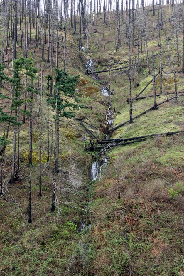
This waterfall is seasonal and on the east side of highway 224. It's within a section of rock cliffs that go along the highway. There are multiple seasonal waterfalls within this cliff section. I decided to only highlight this one since it is one of the more prominent and visible ones. It does to to dry up pretty quick when there isn't consistent rain.
There is a gravel shoulder right next to the waterfall where one could carefully pull off to see it, but it isn't really a pullout and it's within a rock fall area.

Waterfall 45.20370, -122.22811
Coordinates (approximate): 45.20370, -122.22811
Seasonal or Year-Round: Seasonal
Visible From: Highway 224
Best Seen Driving: West (towards Estacada), but can be seen driving in either direction.
This creek with waterfall features cuts into the hillside on the west side of the Clackamas River. It is very beautiful and only visible when driving along the highway. There is no pull-off or place to stop.
Waterfall 45.20287, -122.22797
Coordinates (approximate): 45.20287, -122.22797
Seasonal or Year-Round: Seasonal
Visible From: Highway 224
Best Seen Driving: East (towards Ripplebrook)
This creek has multiple smaller waterfall features and cuts into the hillside on the west side of the Clackamas River. The waterfall features that look line a fan type of falls with multiple tiers. It's also only visible from highway 224 for with no pull-off or place to stop.

Pull-off 45.19999, -122.22537
Coordinates: 45.19999, -122.22537
Use: River access & view of very small seasonal waterfall
River (access, view, none): Access
Parking: Room for a good number of cars. There is a lower and upper pull-off area.
Fee: None
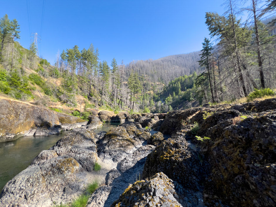
The first large pull-off within the national forest is this one. It's on the corner before coming to Big Cliff, right at mile marker 33. There is an upper and lower pull-off area. It's very popular during the summers and can fit a good number of vehicles.
The lower pull-off gives access to a very rocky beach and the Clackamas River. I took the opportunity to hike from the pull-off down to the rocky beach and along the Clackamas River in this are during January. I had it all to myself. The water moves pretty swift through here. The south side of the beach is near where the South Fork of the Clackamas River comes in, it's on the other side of the river. The current moves pretty swift through here especially during winter.

Waterfall 45.19966, -122.22657
Coordinates (approximate): 45.19966, -122.22657
Seasonal or Year-Round: Seasonal
Visible From: shore of Clackamas River
There was a very small, trickling, seasonal waterfall on the other side of the river. It's visible from the more north end of the beach area. It looked pretty in person, but is very small. My exploring of the rocky beach clocked in 0.3 miles round trip.

Big Cliff
Coordinates: 45.20053, -122.22162
To See: Large rock cliffs
Fee: n/a
Note: Cliffs are either viewable driving along highway 224 or from the far north end of the Historic Memaloose Weigh Station Pull-off.
Best Seen Driving: West (towards Estacada), but is visible driving both directions
"Big Cliff" is a section of rock cliffs that line the Clackamas River gorge between pull-off 45.19999, -122.22537 and the Historic Memaloose Weigh Station. At the north end of the weigh station (around 45.19844, -122.21797) there is a great view of the cliffs and really is the only place to take a picture, or else they are just viewable when driving past. I especially like how they look when driving west (towards Estacada) since the cliffs almost have a ruffled type look.

Historic Memaloose Weigh Station
Coordinates: 45.19686, -122.21694
Use: Parking and view of seasonal waterfalls
River (access, view, none): None
Parking: Room for tons of cars
Fee: None
There isn't anything super special about the weigh station, it's pretty much non-existent at this point. I know the south side is sometimes used for people parking to hike to Clackamas Falls. There's three seasonal waterfalls that can be viewed from the pull-off area towards the north end. I tried finding information online about the weigh station, but couldn't find anything concrete. As far as I can tell it was used during the logging boom, maybe into the 1960's. It hasn't been used as a weigh station for many decades at this point.

Waterfall #1
Coordinates (approximate): 45.19972, -122.21709
Seasonal or Year-Round: Seasonal
Visible From: Highway 224 and weigh station pull-off
This waterfall is furthest to the north. It tends to have a thinner stream than waterfall #2, unless it's after some pretty heavy rain fall. I was able to get this picture after a rainstorm had come through in April so it had more water than usual.

Waterfall #2
Coordinates (approximate): 45.19915, -122.21620
Seasonal or Year-Round: Seasonal
Visible From: Weigh station pull-off
This waterfall tends to have a bit more of a flow rate than #1, but it's more spread out across the rock face it falls down. (I took the photos for waterfalls #1 & 2 at different times, so it might appear as though #2 has less flow based off the photos, but in person #2 almost always has more water than #1).

Waterfall #3
Coordinates (approximate): 45.19846, -122.21577
Seasonal or Year-Round: Seasonal (lasts longer than other waterfalls)
Visible From: Highway 224 and weigh station pull-off
This waterfall is the largest and has the strongest flow rate of the three. It cascades down some rocks towards the top and then falls as a horsetail. It's very pretty. I'm pretty sure this one lasts longer than some of the other seasonal waterfalls, but I'm not sure if it's year-round.

My Wild Adventure is not responsible for your safety, any possible injury, or anything that happens if you choose to follow anything on this website. Maps are not intended to be used for navigational purposes, but to give an overview of the route taken. By going outdoors you are solely responsible to know your strengths and limitations, be aware of current conditions and proceed with the appropriate caution. My Wild Adventure is not responsible for your choices and the outcome. Reference my disclaimer for more information on being responsible outdoors.