Highway 224 & the Upper Clackamas River - Overview
- Tina McLain
- Jul 21, 2025
- 10 min read

Updated: Sep 8, 2025
An overview of all the places to see along the Upper Clackamas River.
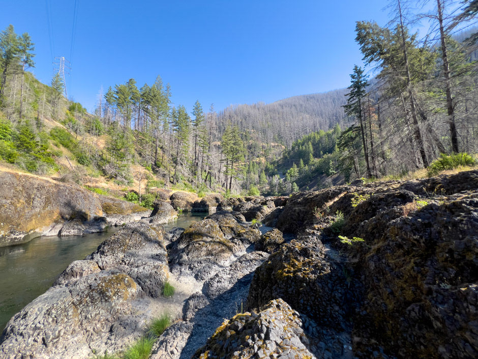
My goal with this project was to lay out all the views, river access sites, hikes, activity options, and waterfalls (year-round and seasonal) along the section of the Clackamas River from Estacada (around the Faraday Dam) to Ripplebrook. This section of river is considered the “Upper Clackamas River” and it is within National Forest, but there are certain areas managed by Portland General Electric (PGE) or Bureau of Land Management (BLM).
I wanted to provide a photo and relevant details for each spot I note within this project. Whether you're wanting to take a scenic drive, sit by the river, hike a trail, swim, white water kayak or raft, fish, or picnic, hopefully you'll find something that interests you.
The section of highway from Estacada to Ripplebrook is 25 miles in length (one direction) and takes about a half an hour to drive. Highway 224 is a paved, two-lane highway with a speed limit of 55 mph. A majority of the way, the highway follows closely along the Clackamas River.
Going into this project I didn’t expect to compile such a long list of places. I really did try to label, photograph, and write about each point along the highway. Due to how long my list became, I’ve had to break this up into a ridiculous number of parts. Eight parts with approximately 10 places in each part. I know I can get annoyed when posts or videos have multiple parts, but breaking it up was really the only feasible way to organize and publish the information. I got to the point when I was trying to do it all in one post that my web editor was slogging. To help make it easier to navigate and find what you want, I created a Google map with all the locations. Within the notes for each waypoint, I note which part that pin corresponds to.
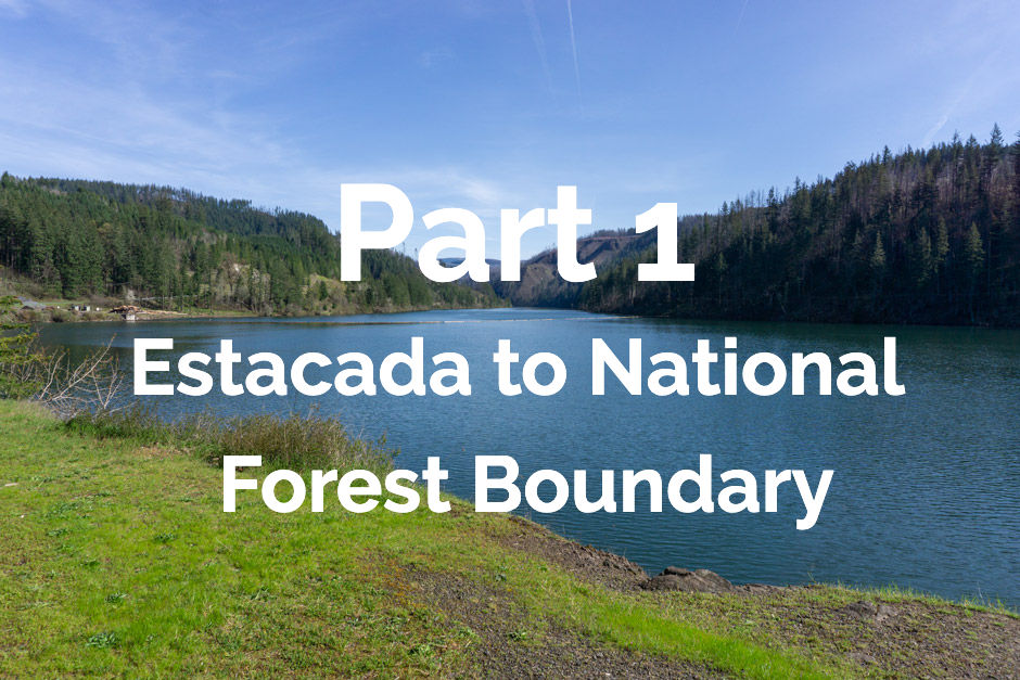
I list the whole map/list of locations from west to east. So Part 1 will start near Estacada and Part 8 will end at Ripplebrook. I note for each pull-off, waterfall, etc., which side of the road it’s located on and which direction driving is easiest to access it from. I also note for pull-offs if there is river access, only a view of the river, or neither.
The rest of this post provides an overview of information and resources. For detailed information about specific waterfalls, pull-offs, etc., go to each part as listed below.
2020 Fires
The Clackamas River area between Estacada and Ripplebrook was heavily affected by the 2020 Riverside Fire. Some aspects of recreation have changed within the burnt area, but there is still so much to see and experience.
Having lived in the nearby area for 9 years now, I frequently drive down Highway 224 along the Clackamas River from Estacada to Ripplebrook and beyond. I've extensively explored this whole section of river, pre- and post-fire. There are certain areas that are no longer accessible such as the Clackamas River Trail #715 and Pup Creek Falls due to fire damage. Even though Pup Creek Falls isn't accessible, it is now visible from Highway 224.
The landscape has changed drastically since pre-fire, but I think there is still beauty and new things to see within burned areas. There a lot of visible seasonal waterfalls now, that pre-fire were hidden by trees. One of my favorite times of year is in the spring when the undergrowth comes in and there’s a blanket of green, which only started happening summer 2024. So even though there are aspects that can be sad when looking at burnt landscapes, I think there is still beauty within it and it’s worth recreating in (if that falls within one’s comfort zone).
There are multiple campgrounds along the Clackamas River, but a large majority were heavily affected by the 2020 fires. I camped in one of the campgrounds in 2014, and since I've lived nearby I haven't camped there since. Plus, when I do camp I tend to do dispersed camping, not staying at campgrounds. Within the Clackamas River Corridor, dispersed camping isn't allowed until after Ripplebrook. I'll note under the Resources Section under Management Areas all the campgrounds along the river. As of January 2025, all are still closed due to the damage from the 2020 fires.
Recreating in Burned Areas
As I’ve noted above, the majority of the Upper Clackamas River was affected by the 2020 fires. Large amounts of the area have reopened as of 2025. There are still a few areas/roads that are closed to public access.
As with any aspect of recreating outdoors, it’s important to make sure what you’re doing is legally open to the public. For up-to-date information on what is open, check out the Mount Hood National Forest website.
Another important aspect to consider when recreating in burned areas is the additional hazards and risks, such as unstable slopes/ground, flash floods, potential for falling trees/limbs, etc.
I really encourage everyone to check out the forest service page, “Safety in Burned Areas,” which discusses how to stay safe in burned areas.
Seasonal Waterfalls Disclaimer
I designate “waterfall” as any amount of water that flows or drops a vertical (or mostly vertical) rock surface. I use the word waterfall rather loosely, and I don’t use any official parameters for what is designated a “waterfall.” Basically if it appears to be falling water, I label it as a “waterfall” for ease of use.
There are a plethora of seasonal waterfalls along the upper Clackamas River. There's no way I could note all of them. So, I'm going to focus on marking those that are 1) most visible from along Highway 224, and 2) the most noticeable/my favorite ones. There are still plenty that I haven’t noted in this post. There are two that I know of that I didn’t add due to it not really being possible to photograph them. So, keep your eyes peeled for waterfalls along the way.
Some are best seen driving a particular direction (east vs. west), so I'll make sure to note which direction has the best visibility when discussing the waterfalls.
Winter/spring is usually the best time to see the waterfalls, particularly after some consistent/heavy rain. There is no guarantee the waterfalls listed will be present at different days/times of year. For the most luck in seeing waterfalls, it’s best to go after there’s been some heavy/prolonged rain along with snow melt.
All seasonal waterfalls are approximate coordinates, it gives the idea of where the waterfall is, but there is room for error on my part.
Pull-offs Disclaimer
I note a majority of the pull-offs along Highway 224, but there are some I’m sure I didn’t cover. It’s as close to being comprehensive as I could get. There is some subjectivity involved as to what constitutes a “pull-off.” So there are some areas others might consider pull-offs that I didn’t note.
There are some pull-offs that have boot paths leading to the river or river views, which I do my best to mention. Most of the photos I took are of the pull-off’s themselves since it is easier to eye that if you go driving yourself. Some places I included pictures of the river, but not in all. I think part of the fun with this list is going to those coordinates and seeing for yourself what it looks like.
Explore the map below to see where each place discussed is located.


Overview by Category
Views
Part 1 - North Fork Viewpoint/Pull-off
Part 2 - Big Cliff
Part 3 - Memaloose Bridge
Part 5 - Carter Bridge
Part 5 - Armstrong Bridge
Part 5 - Pretty Section
Part 7 - Bridge 45.12569, -122.07814
Part 8 - Bridge 45.11621, -122.07515
Pull-off's
Part 1 - Pull-off 45.22652, -122.24959
Part 1 - Pull-off 45.21236, -122.22845
Part 2 - Pull-off 45.19999, -122.22537
Part 2 - Historic Memaloose Weigh Station
Part 3 - Pull-off 45.18866, -122.20210
Part 3 - Pull-off 45.19725, -122.18148
Part 4 - Clackamas Highway Quarry
Part 4 - Pull-off 45.19473, -122.17818
Part 4 - Pull-off 45.18529, -122.16985
Part 4 - Pull-off 45.18272, -122.17324
Part 4 - Pull-off 45.17558, -122.16314
Part 5 - Pull-off 45.16617, -122.15532
Part 5 - White Water Information Site
Part 5 - Pull off 45.16657, -122.13774
Part 5 - Pull-off 45.16757, -122.12449
Part 6 - Pull off 45.15929, -122.11797
Part 6 - Pull off 45.15698, -122.11417
Part 6 - Pull-off 45.15041, -122.10482
Part 6 - Pull off 45.14577, -122.09269
Part 6 - Pull-off 45.14384, -122.09059
Part 7 - Pull-off 45.13810, -122.08294
Part 7 - Pull-off 45.13583, -122.08102
Part 7 - Pull-off 45.12920, -122.07856
Part 7 - Pull off 45.12889, -122.07850
Part 7 - Pull-off 45.12475, -122.07718
Part 7 - Pull-off 45.12487, -122.07516
Part 7 - Pull-off 45.11678, -122.07558
Part 8 - Pull off 45.11404, -122.07310
Part 8 - Pull off 45.10610, -122.07049
Part 8 - Pull off 45.09331, -122.07164
Part 8 - Pull off 45.08363, -122.05695
Part 8 - Ripplebrook
River Access/Day Use Sites
Part 1 - North Fork Reservoir Boat Launch (Seasonal)
Part 1 - The Culvert
Part 1 - Promontory Park
Part 3 - Moore Creek Boat Access Site
Part 4 - Big Eddy Day Use/Picnic Site
Part 5 - Carter Bridge Day Use/Picnic Site
Part 6 - Hole-in-the-Wall Boat Access Site
Part 8 - Sandstone Boat Access Site
Waterfalls (most seasonal)/Creeks
Part 1 - Waterfall 45.21240, -122.23505
Part 1 - Waterfall 45.21245, -122.22850
Part 2 - Waterfall 45.21003, -122.22631
Part 2 - Waterfall 45.20370, -122.22811
Part 2 - Waterfall 45.20287, -122.22797
Part 2 - Waterfall 45.19966, -122.22657
Part 2 - Waterfall #1: 45.19972, -122.21709
Part 2 - Waterfall #2: 45.19915, -122.21620
Part 2 - Waterfall #3: 45.19846, -122.21577
Part 3 - Waterfall 45.18465, -122.19590
Part 3 - Waterfall 45.19211, -122.19655
Part 3 - Waterfall 45.19770, -122.18347
Part 3 - Waterfall 45.19770, -122.18296
Part 4 - Waterfall 45.18947, -122.16837
Part 4 - Waterfall 45.18900, -122.16808
Part 4 - Waterfall 45.18661, -122.16739
Part 4 - Waterfall 45.18102, -122.17571
Part 4 - Angel Falls
Part 5 - Waterfall 45.16800, -122.13380
Part 5 - Waterfall 45.16731, -122.12363
Part 6 - Waterfall 45.15833, -122.11948
Part 6 - Waterfall 45.15780, -122.11845
Part 6 - Pup Creek Falls
Part 6 - Waterfall 45.14981, -122.09756
Part 7 - Deer Creek
Part 7 - Creek 45.11643, -122.07587
Hikes
Part 1 - Cazadero Trail
Part 1 - North Fork Clackamas River Trail
Part 3 - Memaloose and Clackamas Falls
Part 5 - White Water Information Site (a pull-off that also has a short trail)
Part 5 - CLOSED INDEFINITELY - Clackamas River Trail #715
Part 6 - Pull off 45.15929, -122.11797 (a pull-off that also has a trail)
Part 6 - The Narrows
Part 7 - Pull-off 45.12475, -122.07718 (a pull-off that also has a trail)
Part 8 - Alder Flat Trail #574
Activity Ideas
Activities
Kayaking - North Fork Reservoir
Boating - North Fork Reservoir
White Water Kayaking
White Water Rafting
Reference "White Water Information" under Resources for more information.
Bicycling
Cazadero Trail
Cascading Rivers Scenic Bikeway
71 miles of biking from Estacada, OR to Detroit, OR
Fishing
Swimming
The Culvert
The Narrows
Alder Flats
Hiking
Picnicking
Places to Explore Beyond Highway 224
La Dee Flats OHV Area
Pipeline Road between Three Lynx and Lake Harriet
Beyond Ripplebrook Hwy 224 turns into NF-46 which continues to Detroit, OR
Beyond Ripplebrook, you can take NF-57 which goes up to Timothy Lake
Beyond Ripplebrook you can explore FS 46 and FS 63 along the Clackamas and Collawash Rivers.
Resources
Clackamas River
National Wild and Scenic River System - Clackamas River
The document details out what sections of the Clackamas River are designated as scenic vs recreational.
Scenic
"The 4-mile segment from Big Springs to the Forest Service Road 4690 bridge...;"
"the 10.5-mile segment from Oregon State Highway 224 to the June Creek Bridge...;"
"the 5.5-mile segment from Tar Creek to just south of Indian Henry Campground...;"
Recreational
"the 3.5-mile segment from the Forest Service Road 4690 bridge to the junction with Oregon State Highway 224...;"
"the 9-mile segment from June Creek Bridge to Tar Creek...;"
"the 14.5-mile segment just south of Indian Henry Campground to Big Cliff....”
Management Areas
PGE
Mount Hood National Forest
Campgrounds
Carter Bridge Campground - Closed
Lockaby Campground - Closed
Fish Creek Campground - Closed
Roaring River Campground - Closed (to entry as well)
Sunstrip Campground - Closed
Indian Henry Campground - Closed
Ripplebrook Campground - Closed
Past Ripplebrook the Riverside Campground is tentatively planning on being opened in 2025. So, besides Promontory Park Campground, this is the only nearby campground option.
Also note that dispersed camping isn't permitted along Highway 224 from the forest boundary (near Promontory Park) to Ripplebrook. At this point, with road closures and what not, going down Forest Road 46, 57, or 63 are your best bets for dispersed camping.
Water Safety
I'd like to really stress the importance of water safety, not to fear monger, but to remind everyone to have a healthy respect for water. There have been multiple drownings along the Clackamas River throughout the years. Some causes have been cold water shock when cliff jumping, drinking and falling into the river, and recreating during unsafe river conditions without the proper experience. One of the main points to highlight is that the river temperature is cold, and it doesn't "warm up" during the summer to the point where hypothermia and cold shock aren't a concern.
Water conditions can change particularly during different times of year so it's important check conditions before going. I added some resources below about water safety and drownings, again not to fear-monger or shame those who have died, but it can be useful to educate oneself on the risks and learn from the accidents that have happened.
KOIN - "Despite hot temps, ocld water danger persists" (2024)
KOIN - "What is cold water shock? Why is it dangerous?" (2024)
"About 50 people drown in Oregon waters every year, officials said. About 35 of those accidental drownings are teenagers."
"89% of people who drown weren’t wearing a life jacket."
OregonLive - "How a landlocked Oregon county was named 'most dangerous in U.S. for beachgoers'"
My Wild Adventure is not responsible for your safety, any possible injury, or anything that happens if you choose to follow anything on this website. Maps are not intended to be used for navigational purposes, but to give an overview of the route taken. By going outdoors you are solely responsible to know your strengths and limitations, be aware of current conditions and proceed with the appropriate caution. My Wild Adventure is not responsible for your choices and the outcome. Reference my disclaimer for more information on being responsible outdoors.


