Hike to Roaring River From Pull-off 45.15929, -122.11797
- Tina McLain
- Jul 7, 2025
- 5 min read

A short boot path hike past a target shooting area to the edge of Roaring River.

Access: Unmarked & unnamed trail, turns into faint boot path closer to the river
Distance: 0.48 miles (round trip)
Elevation Range: 968' to 1004'
Ascent/Descent: +53 ft/-45 ft
Route Type: In and out
Route: Unmarked trail from pull-off 45.15929, -122.11797 which turns into multiple faint boot paths to different points along Roaring River
Outing Type: Day hike
Permits/Fees: None
Notes: There is a target shooting area the trail leads to, so be very aware of anyone else within the area, especially if target shooting is happen.
Location: Near where Roaring River meets up with the Clackamas River in Mount Hood National Forest, Oregon, U.S.A.
Administration: Mount Hood National Forest
Ranger District: Clackamas River Ranger District
Date Accessed: April 9, 2025 & April 23, 2025
I explored this unnamed & unmarked trail for the first time towards the start of April with my dad. I only went to the first river edge I mention below. I came back on the 23rd and explored all the spur trails I could find leading down to different sections of Roaring River. Before I'd explored this trail I was aware that it seemed to be used for target shooting, but had never ventured to explore the area myself.

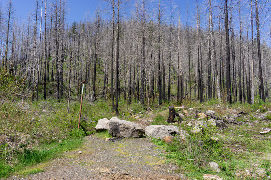
I started my hike from an unmarked pull-off at 45.15929, -122.11797. It's right before the bridge that goes over Roaring River and is on the west side of Roaring River. There's room for a few cars. The pull-off is a little more "trashy" because people seem to sometimes dump trash here.
The trail starts behind 3 large boulders and is very easy to see. I followed the trail which was over 3 ft wide through the burnt forest. There was one small tree down across the trail. The forest was alive with birds, bugs, and there was green underbrush everywhere. It's really amazing how five years after the fires, there's starting to be some greenery again.

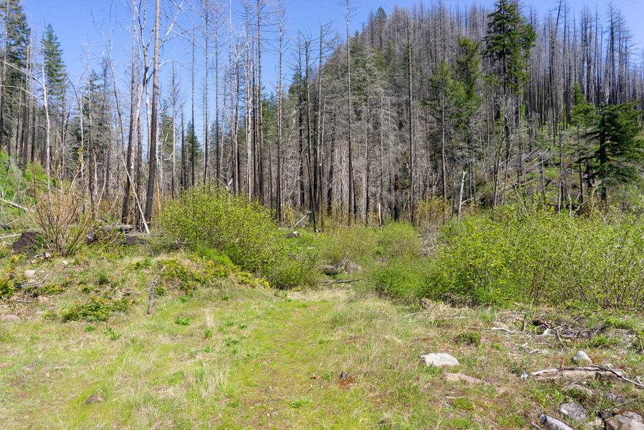
The trail leads to an open area that has obviously been used for target shooting, there was some trash around too. The trail continues along the target shooting area along the south side until 45.16027, -122.11590.
The trail starts to disappear and then seem to end if continuing east, but at these coordinates there is a spur trail that's more lightly used headed to the south. It's a bit harder to see on and off, especially with all the grass and foliage starting to come in. I think it would be easier to see in the winter months with underbrush more dormant.
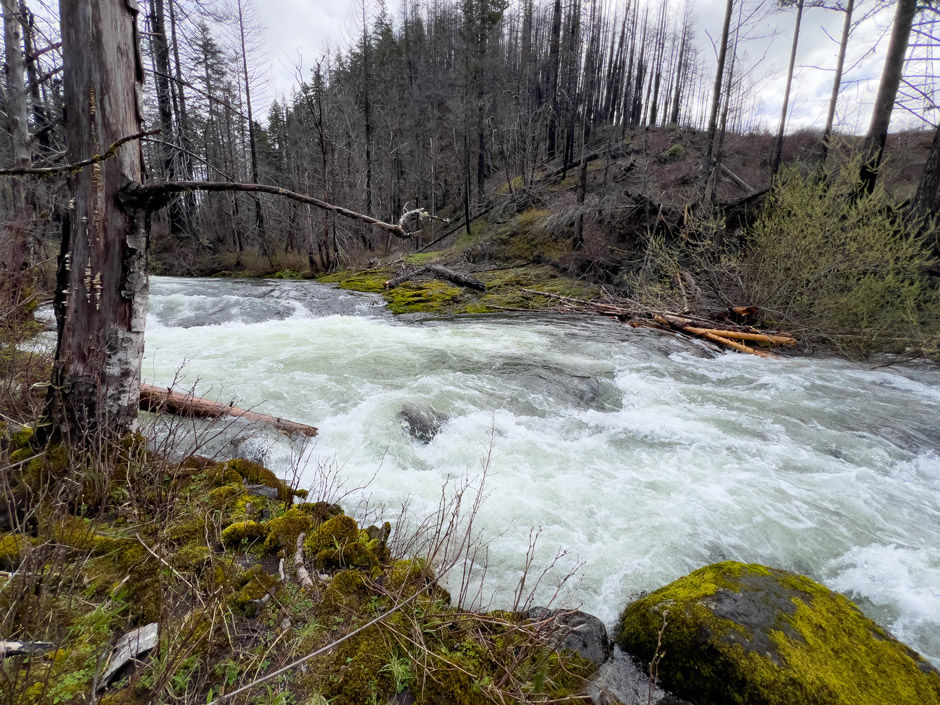
The light boot path continues to 45.16013, -122.11583 and splits in two directions. I followed the path to the left, that goes east towards the river. It's the spur I took when I has there earlier in April. The river was loud even from a distance. There were some downed trees I had to climb over as I got closer to river.

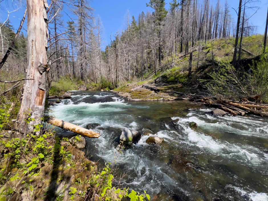
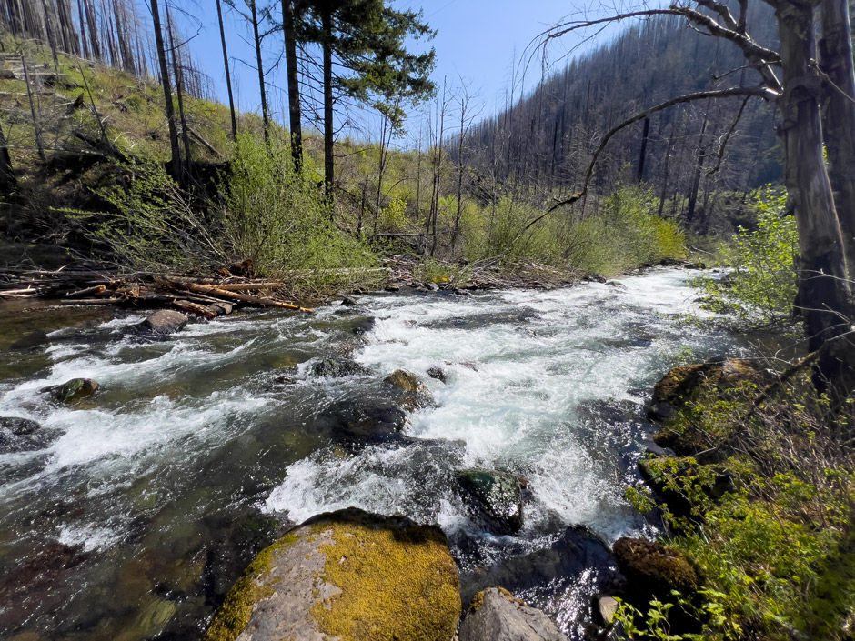
The trail got lighter, and lighter making it harder to follow. But it eventually took me to the very edge of Roaring River. I was shocked, in earlier April the river looked like it was nearly bursting with water and the rapids were insane. In just two weeks, the flow rate had decreased and I could see the bottom of the river! The difference was crazy. This spot along the shore was more just a place with a view, not necessarily somewhere to sit and just be.

I made my way back to where the trail split in two and followed the trail that went further downstream and traveled south. The trail through this section was a little bit harder to follow, but it took me to 45.15984, -122.11558 along the river.

I was shocked, there was large rock outcroppings lining the edge of the river. A very small scale version of the Narrows. I was so excited and spent quite a bit of time taking photos and exploring along the rocks. The rapids through this section were very beautiful.
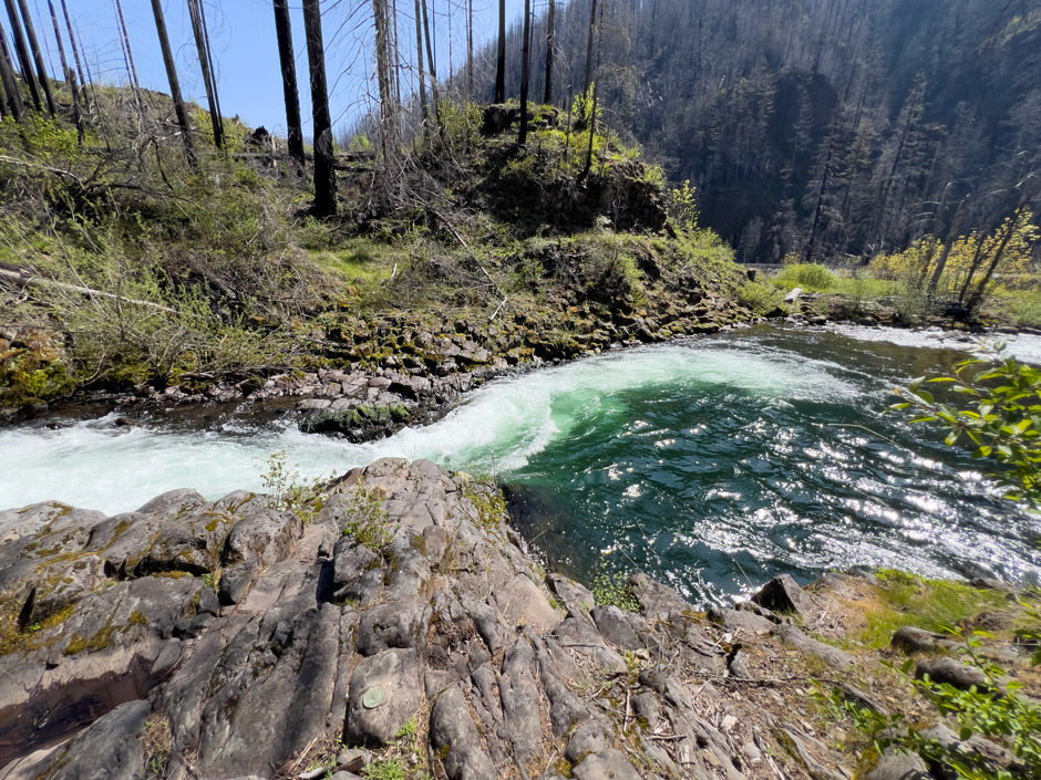
Toward the west end of the rock outcropping there was the slightest hint of a trail continuing southwest. I decided to try following it. Turns out there wasn't much to follow and it felt more like a bushwhack. The trail edged along the steep bank of the river and it took me to another place with a smaller and taller rock outcropping that gave view to a huge pool after a powerful, funneled rapid at 45.15951, -122.11579.
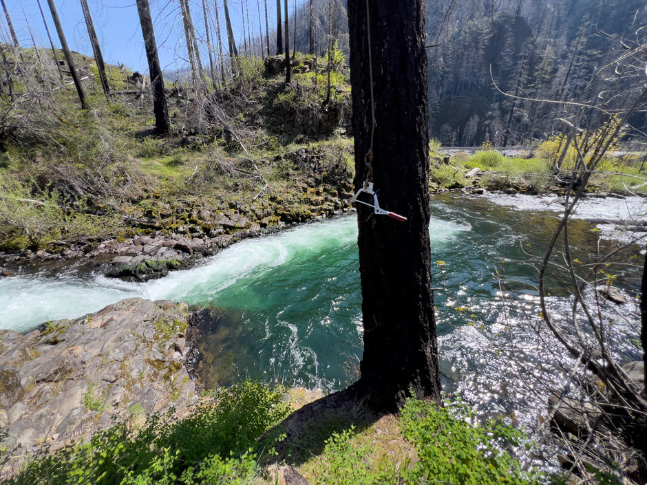
It was apparent people had been here before with a rope and handle tied to a burnt tree for swimming. There was a concrete block nearby falling apart. I had no idea what it was for. Any hint of a trail beyond this point didn't appear to exist so I turned around and made my way back the way I'd come.

I made my way back to the target shooting area. I tried to see if there was a trail leading west from 45.16027, -122.11590. I looked like a true bushwhack to continue towards the Wilderness boundary. I decided to call it a day, and if I was in a real adventurous mood I'd come back at a different time and try bushwhacking towards the wilderness boundary.
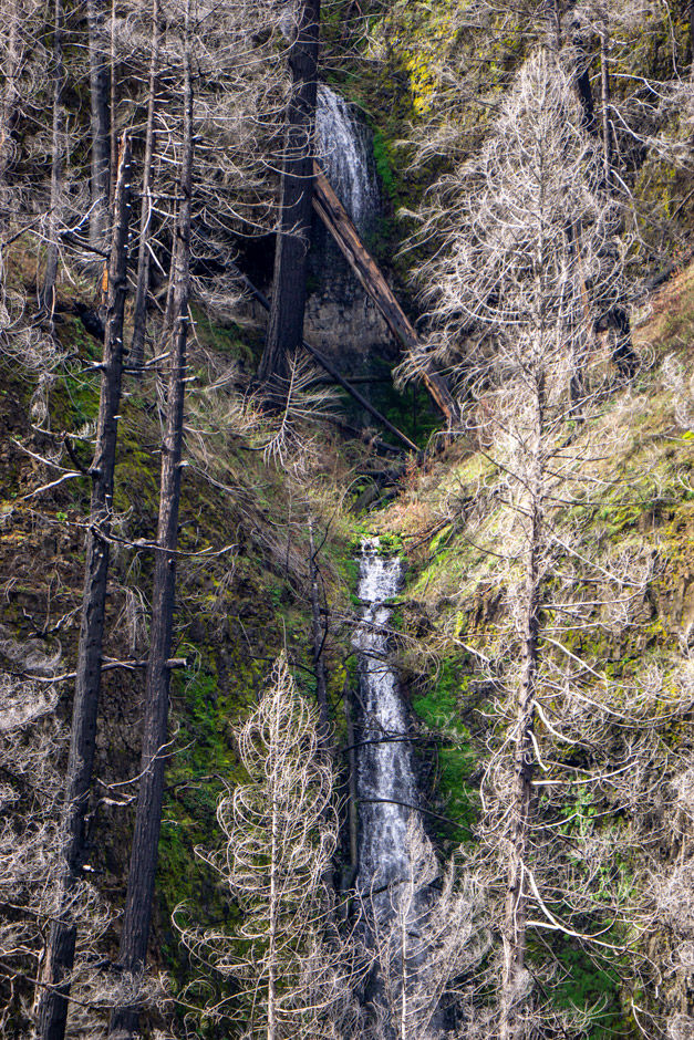
On the way back down the trail towards the car, it's possible to see two seasonal waterfalls on the other side of the Clackamas River. The spot on the trail is 45.15962, -122.11776 to see waterfall 45.15833, -122.11948 (seasonal).

At the pull-off, to the east of it around 45.15927, -122.11750 is the best place to see waterfall 45.15780, -122.11845 (seasonal).
Resources
I couldn't find anything online mentioning this trail or even the target shooting area.
How to get there (from Estacada, OR)
Take Highway 224 east of out Estacada, OR for 17 miles. The pull-off is on the north side of the road and is easy to miss. It's right before the bridge that goes over Roaring River and is on the west side of Roaring River.
If you've gotten to the point you're passing Roaring River Campground, you've gone too far.
Coordinates
Pull-off: 45.15929, -122.11797
Start of trail: 45.15939, -122.11789
View of waterfall (45.15833, -122.11948) from trail when looking back across Clackamas River: 45.15962, -122.11776
Trail cuts off towards river: 45.16027, -122.11590
Split in trail (both lead to river): 45.16013, -122.11583
River edge #1: 45.16006, -122.11529
River edge #2: 45.15984, -122.11558
River edge #3: 45.15951, -122.11579
Place to view second waterfall (45.15780, -122.11845) east of pull-off: 45.15927, -122.11750
Map
My Wild Adventure is not responsible for your safety, any possible injury, or anything that happens if you choose to follow anything on this website. Maps are not intended to be used for navigational purposes, but to give an overview of the route taken. By going outdoors you are solely responsible to know your strengths and limitations, be aware of current conditions and proceed with the appropriate caution. My Wild Adventure is not responsible for your choices and the outcome. Reference my disclaimer for more information on being responsible outdoors.


